Welcome to the new site! More changes and additions to come.
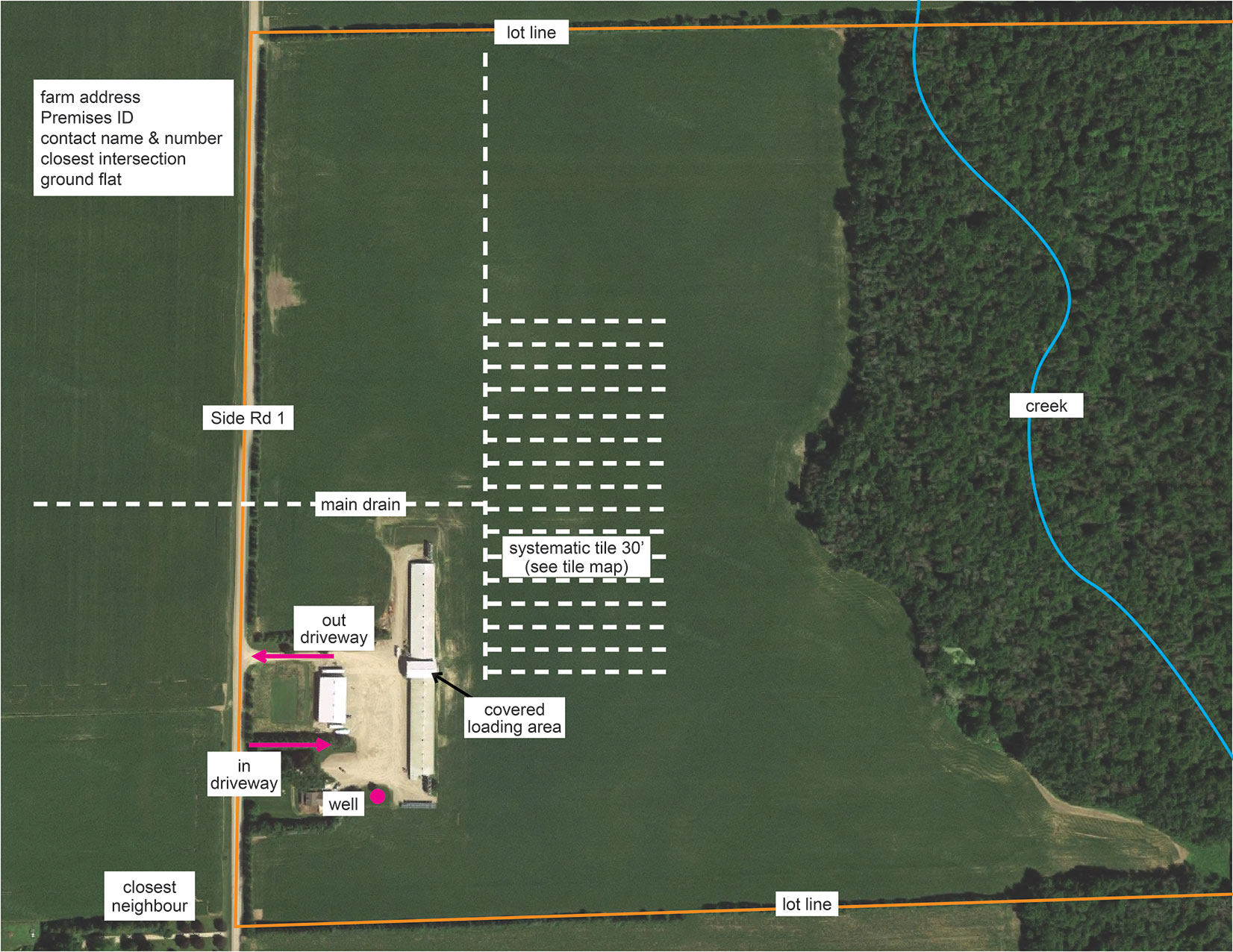
A site map is a useful resource in an emergency. One of the easiest ways to create a site map for your farm is to download aerial photos of your property from Google Maps. Important features of your property can be added digitally or manually to the map, creating a valuable addition to your emergency binder.
Ontario Pork staff can help you get started. If you have any questions, reach out to [email protected]. OMAFRA’s AgMaps is another useful mapping tool.
We’ve done a full property image and a close-up of the barn to show you what information is helpful for first responders, including CFIA, during an emergency.
This information is important when making plans for composting or burial of large volumes of deadstock.
Got questions about our emergency planning or need a bit more info? Our team’s ready to help—just reach out, and we’re happy to assist!
Sign up to our daily news brief for industry news and daily pricing.
+1 (519) 767-4600
8:30AM - 4:30PM (Mon-Fri)
655 Southgate Dr., Guelph, ON
N1G 5G6
Copyright © 2025 Ontario Pork Producers' Marketing Board. All rights reserved.